
Ice Storm
An Ice Storm is a freezing rain situation (rain that freezes on surface contact) with significant ice accumulations of 0.25 inches or greater.
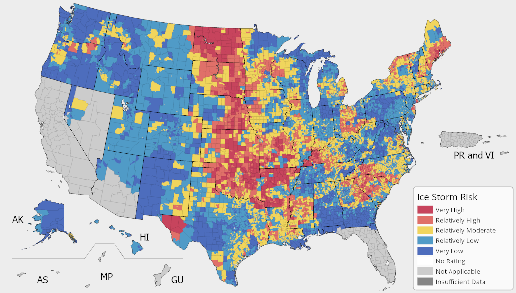
In the National Risk Index, an Ice Storm Risk Index score and rating represent a community's relative risk for Ice Storms when compared to the rest of the United States. An Ice Storm Expected Annual Loss score and rating represent a community's relative level of expected building and population loss each year due to Ice Storms when compared to the rest of the United States.
Ice Storm Exposure
An Ice Storm exposure value represents a community's building value (in dollars) and population (in both people and population equivalence) exposed to Ice Storms.
Ice Storm Annualized Frequency
An Ice Storm annualized frequency value represents the average number of recorded Ice Storm hazard occurrences (event-days) per year over the period of record (67.1 years).
Ice Storm Historic Loss Ratio
An Ice Storm historic loss ratio is the representative percentage of the exposed consequence type value (building or population) expected to be lost due to an Ice Storm hazard occurrence.
Ice Storm Processing Methodology
For comprehensive details about the Ice Storm processing methodology, see the National Risk Index Technical Documentation.